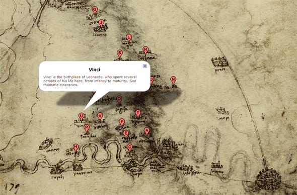
While visiting the Institute and Museum of the History of Science in Florence last year, Director Paolo Galluzzi treated us to a sneak peek inside a new feature on his musem’s media-rich web site: maps drawn by Leonardo da Vinci scanned and posted in a Google maps interface so we could compare the renaissance originals with modern cartography. It is all a part of his philosophy that making the museum’s entire collection available on-line is not just good for business, but it could allow new forms of research into the history of science – something that will directly impact future research. At first glance it’s quite clear that the maps have lost something over the centuries as they became slightly more accurate. But this project holds a tremendous amount of promise – imagine if the web’s collective intelligence could be applied to research through more tools like this one, exposing artwork long stored in museums and libraries to intellectual scrutiny and discovery!
renaissance map
This entry was posted in art, blogogracy, free & open, maps, visualization. Bookmark the permalink. Both comments and trackbacks are currently closed.
